It looks like you might have accessed this page from an outdated address. Please update bookmarks and links to:
Oklahoma Mesonet Releases 2025 Extremes Map
Published: Monday, December 15, 2025
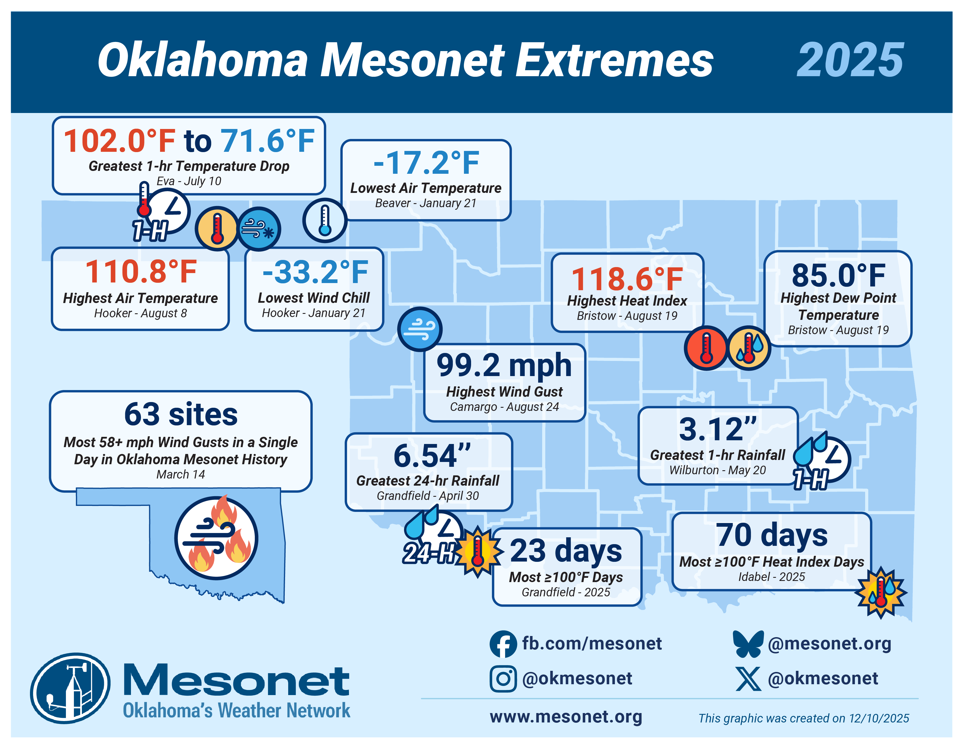
Each year the Oklahoma Mesonet creates a map showing the most extreme events that were recorded by the network throughout the year. The year was milder than we typically experience, but we identified 12 "extremes":
- Statewide - Most 58+ mph Wind Gusts in a Single Day in Oklahoma Mesonet History: 63 sites on March 14
- Beaver - Lowest Air Temperature: −17.2°F on January 21
- Bristow - Highest Dew Point Temperature: 85.0°F on August 19
- Bristow - Highest Heat Index: 118.6°F on August 19
- Camargo - Highest Wind Gust: 99.2 mph on August 24
- Eva - Greatest 1-hr Temperature Drop: 102.0°F to 71.6°F on July 10
- Grandfield - Greatest 24-hr Rainfall: 6.54" on April 30
- Grandfield - Most 100°F Days: 23 days
- Hooker - Highest Air Temperature: 110.8°F on August 8
- Hooker - Lowest Wind Chill: −33.2°F on January 21
- Idabel - Most 100°F Heat Index Days: 70 days
- Wilburton - Greatest 1-hr Rainfall: 3.12" on May 20
This graphic was created on December 10, 2025.